
Home » Routes » Europe » Wales » Snowdonia National Park » Low Level and Easier Walks in Snowdonia » Pen yr Allt Trail Walk from Betws-y-coed
Pen yr Allt Trail Walk from Betws-y-coed
By Dave Roberts 
on March 25, 2016 No ratings yet.
Posted as a walk in – Europe, Low Level and Easier Walks in Snowdonia, Snowdonia National Park, Wales, Woodland Walks in Snowdonia
Pen yr Allt Trail Walk from Betws-y-coed
Route Essentials
Route Summary
See the end of the article for local information about parking, public transport facilities, pubs and cafes.
Distance
6.9 km
Ascent
273 m
Time
2 hours
Calculate the time using Naismith’s Rule and factor in your own pace.
Start Location
Betws y Coed
Difficulty
Moderate Walk
Hazards
Weather Forecast:
Check out our Best Mountain Weather Forecast?
Remember that we cannot outline every single hazard on a walk – it’s up to you to be safe and competent. Read up on Mountain Safety , Navigation and what equipment you’ll need.
Pen yr Allt Trail Walk from Betws-y-coed Ordnance Survey Map and GPX File Download
Pen yr Allt Trail Walk from Betws-y-coed
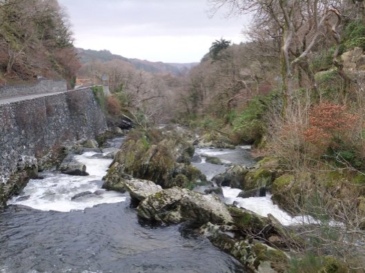
Walking from Betws-y-coed, you’ll probably want to walk along the Afon Llygwy as well as taking in the woodland that the village is named after. The Pen yr Allt waymarked trail provides both, with a steep walk to start with, descending back through the forest and returning to the village along the river bank. A good all rounder that’s been waymarked all the way around with blue way-markers.
More information, and a printable map (though you can barely make out details on the map, it is useful used in conjunction with a proper OS Map) can be downloaded from the Natural Resource Wales site – Pont y Pair and Pont y Pair Trails Information Sheet.




Local Information and Recommended Maps and Guidebooks
Route Summary:
Route Start Location: Betws y Coed
| Distance |
Ascent |
Time |
| 6.9 km | 273 m | 2 hours |
Calculate the time using Naismith’s Rule and factor in your own pace.
Activivity Type: Moderate Walk
Summits and Places on this Route
Facilities
Plenty of cafes and hotels in the village as well as a convenience store.
Hazards
Remember that we cannot outline every single hazard on a walk – it’s up to you to be safe and competent. Read up on Mountain Safety , Navigation and what equipment you’ll need.
Parking :
Various spots in Betws-y-coed – near Cunninghams next to the bridge is probably the most convenient.
Public Transport:
The Snowdon Sherpa and the Conwy Valley railway line run through Betws-y-coed.


Guidebooks:
 |
 |
 |

Dave Roberts
More Posts by Dave Roberts

Pen Llithrig y Wrach and Pen yr Helgi Du from Capel Curig

The Landsker Borderlands Trail
