
Home » Routes » Europe » England » Lake District National Park »
Best Walks from Keswick in the Lake District
By Dave Roberts ![]()
Best Walks from Keswick in the Lake District
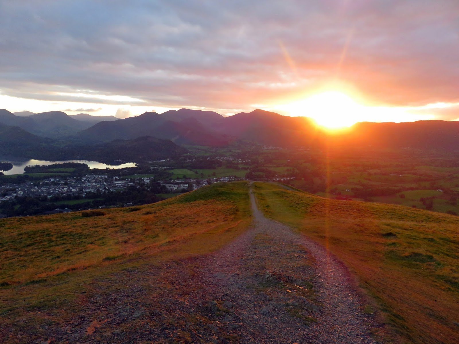
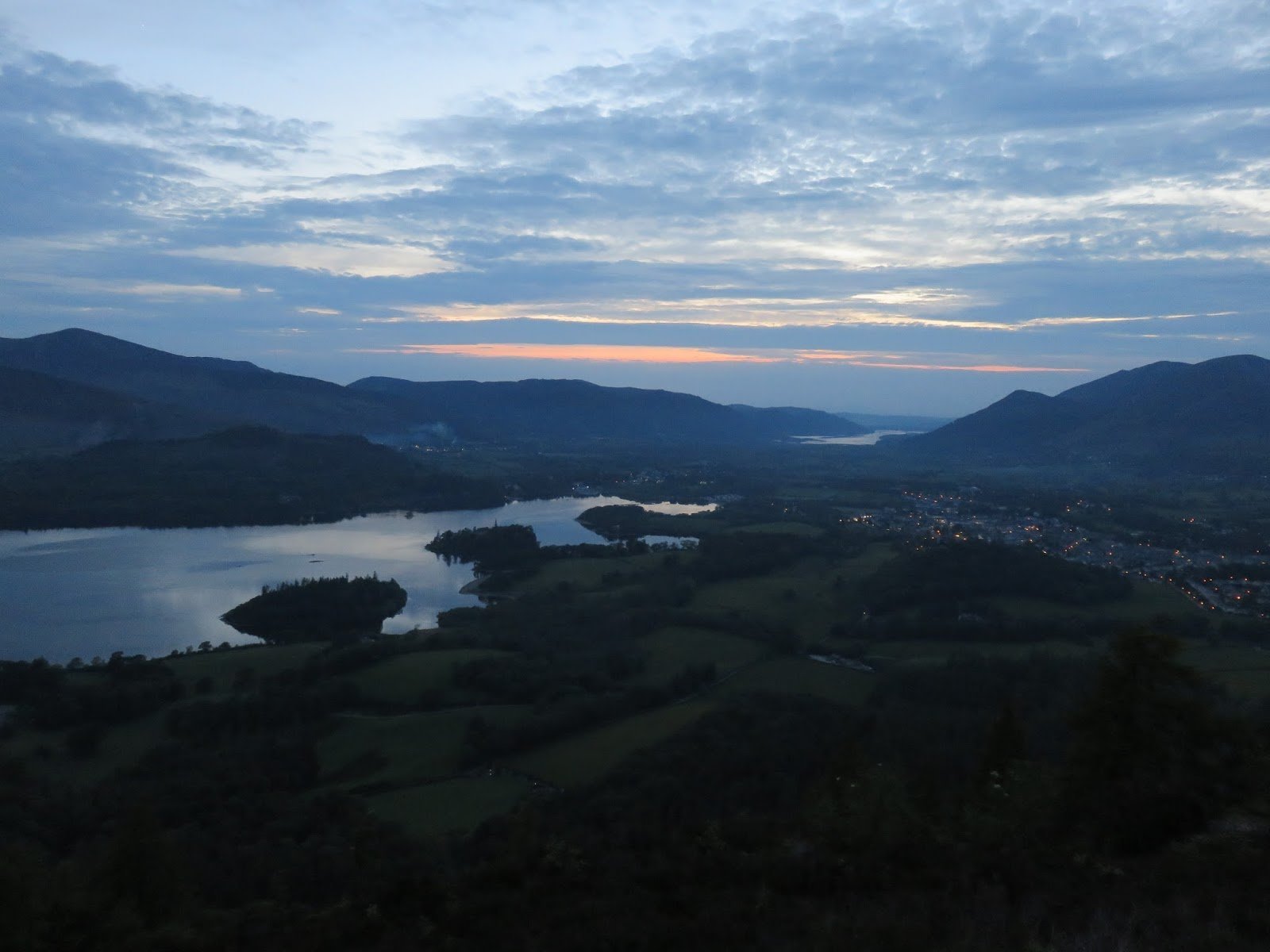
The Lake District town Keswick is situated between the sixth largest mountains in England, Skiddaw, which lies north, and one of the major bodies of water in the Lake District national Park, Derwent Water, to the south. The town is a perfect base to explore Cumbria, and the Lakeland fells with well known names such as Catbells, Scafells, Great Gable, Skiddaw and Blencathra to explore.
The walks have been chosen as those that start from Keswick (or within walking distance) and those walks for which it would be a suitable base – such as Helvellyn and Scafell Pike.
What’s In Keswick? As with Betws y Coed in Snowdonia, Keswick in the Lake District boasts a great selection of outdoor/walking retailers. You could also purchase local goods at the Keswick market that runs every Saturday year round, and on Thursdays mid February to December. Sitting in one of the most dramatic locations, you could visit the Castlerigg stone circles which date back 3000 BC during the Neolithic period. We’re also told the Derwent Pencil Museum the home of the first pencil is a must see!
How Can I Get To Keswick? Arriving by train your nearest station stop would be at Penrith, which is a good 27km drive away. If arriving Keswick by road take junction 40 off the M6 and follow the A66, or from the south you can take junction 36 and follow A591 which takes you through Windermere, Ambleside and Grasmere. Keswick also has a good provision of local bus links to other Lake District towns and villages, or why not become a seafarer (or should that be lakefarer?!) and make use of the Keswick Launch?
What Pubs and eateries are there in Keswick? This is one of the main hubs in the Lake District and as such choice is in abundance, in fact you’re spoilt for choice! Highlights include The Wainwright and Bank Tavern which offer local ales for those thirsty walkers.
Maps for Keswick Walks: We recommend the ORDNANCE SURVEY Explorer OL4 The English Lakes – North Western area With Digital Version , ORDNANCE SURVEY Explorer OL5 The English Lakes – North Eastern area Map and the Lake District BMC (British Mountain Map) from Harvey.
Recommended Guidebooks: We recommend either the Lakeland Fellranger series by Cicerone or the Wainwright’s Illustrated Walking Guides to the Lake District.
Weather Forecast: Met Office Lake District Mountain Weather for Keswick
Catbells From Hawes End Derwentwater
Height Gained – 400 metres , Distance – 6.3 km, Time –2 hours
This first entry on the list is hardly a surprise, and one of the most popular easy fells in the Lake District. With extensive views over the surrounding mountains and Derwentwater, there’s a lot of reward for such a modest hill. Best walked by taking the Keswick Launch to Hawes End rather than taking the car along the already busy narrow roads to the overflowing car parks nearby.


Latrigg from near Keswick
Height Gained – 90 metres , Distance – 2 km, Time –1 hours
Latrigg is an even easier walk than Catbells, especially if you start from the Underskiddaw car park. You can also follow the Cumbria Way in order to start this walk from the centre of town and provide a longer outing. You can return the same way or via Brundholme Wood.
Skiddaw Via Sale How from Keswick
Height Gained – 1040 metres , Distance – 21 km, Time –7 hours
One of many routes up Skiddaw from Keswick, this walk takes you around the back way as you follow the Cumbrian Way as far as YHA Skiddaw House before ascending via Sale How. The route returns to Keswick via the popular Jenks Hill path, which provides an easier option for Skiddaw from Keswick (but it’s still 17km up and down!)
Walla Crag from Castlerigg
Height Gained – 200 metres , Distance – 3.6 km, Time –1.5 hours
Despite the lowly height of 376 metres, this makes a worthy quick walk from Keswick. It is one of Wainwright’s Central Fells and provided an excellent viewpoint across Derwentwater.
Castlerigg Stone Circle Walking Route from Keswick
Height Gained – 160 metres , Distance – 7 km, Time –2 hours
The stone circle at Castlerigg is one of the more popular locations in the Lake District, with the small car park usually full most times. Much better is to walk there from Keswick town centre by following this easy walking route.


Castlehead From Keswick
Height Gained – 90 metres , Distance – 2.7 km, Time –1 hour
Castlehead is a viewpoint just outside Keswick that can be reached with a short stroll from the town centre. It’s a pleasant walk, with extensive views of the surrounding fells and returns via Derwenwater, the Theatre by the Lake and Hope Park.


A Circuit of Derwentwater
Height Gained – 280 metres , Distance – 14.5 km, Time –4 hours
Keswick’s very own water is one of the best low level walks in the area. It’s not easy, at just shy of 15km, and still has it’s share of ascent – because let’s face it, hardly any low level walks in the mountains are ever totally flat! If you wanted a shorter excursion, then judicious use of the Keswick Launch can take you between numerous launches on Derwentwater.

Blencathra Sharp Edge
Height Gained – 720 metres , Distance – 9.2 km, Time –4 hours
This route starts outside Keswick at Scales on the A591, and ascends Blencathra (Saddleback) along one of the classic scrambling routes in the Lake District – Sharp Edge. Sharp Edge is a grade 1 scramble, complete with a knife edged arete and it’s very own Bad Step. You’ll need a head for heights to complete the roue, which is generally straightforward in dry conditions. It does, like all scrambles, need a bit more care in the wet when the Bad Step can be treacherous, and a slip fatal. An ascent via Scales Fell is recommended if that sounds a bit too hairy!


Helvellyn from Thirlmere
Height Gained – 1040 metres , Distance –15 km, Time –5 hours
While this walk does not start directly from Keswick, we think it would be rather remiss of us to exclude the walk up Helvellyn from Thirlmere. While not as exciting as the approaches up Helvellyn from Glenridding and Patterdale, it’s still a worthy ascent with excellent views over Thirlmere and towards Skiddaw.

Coledale Round
Height Gained – 1350 metres , Distance – 17 km, Time –7 hours
The Coledale Round is a Lakeland classic horseshoe. Starting from Braithwaite on the outskirts of Keswick this route initially ascends the minor hill of Barrow, which is a short excursion in itself for those who want something on a similar level to Catbells. It’s then over the Wainwrights around Coledale, from Crag Hill to Grasmoor, Hopegill Head and finally down over Grisedale Pike.


High Spy, Maiden Moor and Cat Bells from Derwentwater
Height Gained – 815 metres , Distance – 14.5 km, Time –5 hours
The final route on our Walks from Keswick is this longer route involving Catbells that continues onward to the higher peak of High Spy before returning on a scenic low level route through Borrowdale.


Local Information and Recommended Maps and Guidebooks


Guidebooks:
 |
 |
 |
 |
 |
 |
![]()
Dave Roberts
More Posts by Dave Roberts

Tryfan South Ridge Grade 1 Scramble

Walk to Llyn Llywelyn from Rhyd Ddu
