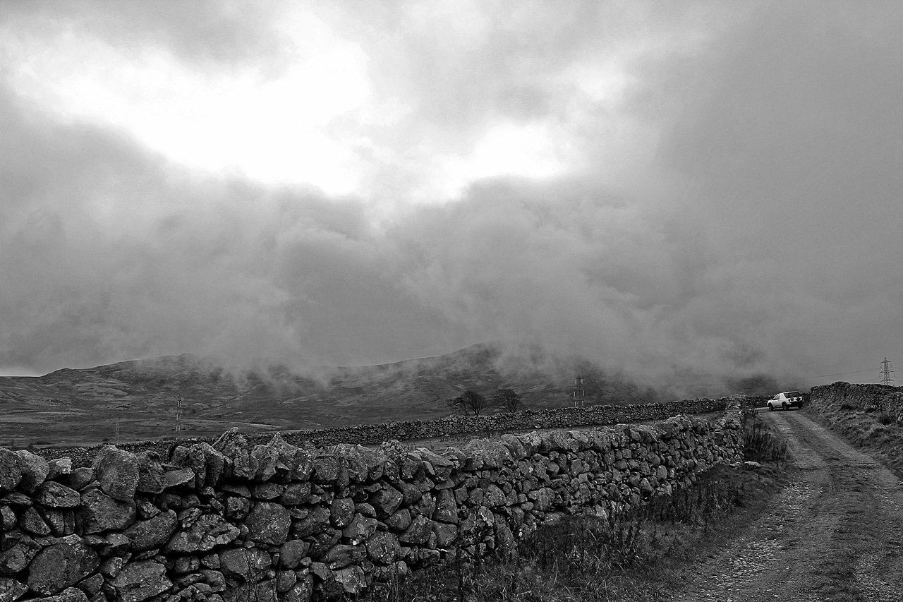
Carneddau and Foel Fras from Rowen Youth Hostel
By Dave Roberts ![]()
on March 4, 2016 No ratings yet.
Posted as a walk in – Europe, Snowdonia National Park, The Carneddau, Wales
Carneddau and Foel Fras from Rowen Youth Hostel
Route Essentials
Route Summary
A wilder side to the Carneddau
See the end of the article for local information about parking, public transport facilities, pubs and cafes.
Distance
19.69 kmAscent
909 mTime
6 hoursCalculate the time using Naismith’s Rule and factor in your own pace.
Start Location
Rowen
Difficulty
Hard Walk
Hazards
Weather Forecast:
Met Office Snowdonia Mountain Weather
Check out our Best Mountain Weather Forecast?
Remember that we cannot outline every single hazard on a walk – it’s up to you to be safe and competent. Read up on Mountain Safety , Navigation and what equipment you’ll need.
Carneddau and Foel Fras from Rowen Youth Hostel Ordnance Survey Map and GPX File Download
Carneddau and Foel Fras from Rowen Youth Hostel
The Rowen Youth Hostel is idyllically placed above the Conwy Valley and well placed to approach the Carneddau, even if it is a bit of a yomp! This walk takes in Drum, Foel Fras and Pen y Castell, but you could easily omit Foel Fras for a shorter day. Likewise, you could add Tal y Fan for a tougher circuit.
Carneddau and Foel Fras from Rowen Youth Hostel Route Description
1 Start off along the green lane uphill. You’ll reach a junction after around 1.5km, continue uphill along this lane until you reach the Bwlch y Ddeufaen car park after 3km. From here, the actual pass of Bwlch y Ddeufaen is around 1km walk along the route of the Roman Road.
2 From the bwlch, pass through the gate and follow the wall to your left. Ensure you follow on this side as there are impassable walls on the left side of the wall! A faint path is easily followable next to the wall for the next 1.3km, after which the going eases as you reach the main ridge of the Carneddau.
3 Follow the fence left along the grassy, and boggy in places, ridge over the minor summit of Carnedd y Ddelw and stop here awhile to enjoy the view!
4 The summit of Drum is quickly reached by following the fence, and is yet another fine viewpoint! You can descend directly to Pen y Castell from here, but it’s worth ascending Foel Fras if time allows.
5 Descend the good track SSW from the summit, which brings you to a boggy looking col. This is easy enough to cross, with plenty of crossing points, and the way up to Foel Fras is marked by a fence and a wall. The path can be sketchy in places, but the wall provides a foolproof guide. You can ascend either side of the wall, which can be a bonus in windy conditions. Though odds on, you’ll find that the wind is blowing along the wall.
6 Foel Fras has a stony, flat summit that’s typical of the main Carneddau ridge. It’s marked by the only trig point in the High Carneddau. You can continue on to Carnedd Llywelyn if you’ve plenty of time, it’s further than you think! It’ll add another 8km to the walk, and around 2.5 hours!
7 Retrace your steps back to Drum, and turn right down the fence towards Pen y Castell. It can be boggy in places, but dries off as you climb to the summit.
8 Descent from here is either as direct as you can get to the good track below, or along the summit ridge over Penygadair. Pick your own route down, but once on the track the going is straightforward enough, and becomes a metalled road after around 20 minutes.

© Copyright Ian Greig and licensed for reuse under thisCreative Commons Licence
9 Follow the road downhill (there’s also a right of way that you could follow left from the small car park – this cuts a corner on the route) and at the junction with the country lane below, turn left. You’ll rejoin the track you set off on at leg 1 after 2.5km where you’ll turn right for the final 1.5km to the YH.
Local Information and Recommended Maps and Guidebooks
Route Summary:
A wilder side to the Carneddau
This walk includes the Washi of Foel-fras (Carneddau)
This walk includes the 2 Hewitts of Foel-fras (Carneddau), DrumThis walk includes the 4 Nuttalls of Foel-fras (Carneddau), Drum, Carnedd y Ddelw, Pen y CastellRoute Start Location: Rowen
| Distance |
Ascent |
Time |
| 19.69 km | 909 m | 6 hours |
Calculate the time using Naismith’s Rule and factor in your own pace.
Activivity Type: Hard Walk
Summits and Places on this Route
Facilities
Ty Gwyn Hotel in Rowen is recommended.
Check out the businesses nearby for more places to stay and drink.
Hazards
Remember that we cannot outline every single hazard on a walk – it’s up to you to be safe and competent. Read up on Mountain Safety , Navigation and what equipment you’ll need.
Parking :
Public Transport:
Weather Forecast:
Met Office Snowdonia Mountain Weather
Check out our Best Mountain Weather Forecast?
![]()
Dave Roberts
More Posts by Dave Roberts

Tryfan South Ridge Grade 1 Scramble

Walk to Llyn Llywelyn from Rhyd Ddu


