
Arenig Fawr via Simdde Ddu Catwalk
By Dave Roberts ![]()
on July 27, 2011 No ratings yet.
Posted as a walk in – Europe, Snowdonia National Park, The Arenig, Wales
Arenig Fawr via Simdde Ddu Catwalk
Route Essentials
Route Summary
See the end of the article for local information about parking, public transport facilities, pubs and cafes.
Distance
12.32 kmAscent
687 mTime
Calculate the time using Naismith’s Rule and factor in your own pace.
Start Location
Difficulty
Hard Walk
Hazards
Weather Forecast:
Met Office Snowdonia Mountain Weather
Check out our Best Mountain Weather Forecast?
Remember that we cannot outline every single hazard on a walk – it’s up to you to be safe and competent. Read up on Mountain Safety , Navigation and what equipment you’ll need.
Arenig Fawr via Simdde Ddu Catwalk Ordnance Survey Map and GPX File Download
Arenig Fawr via Simdde Ddu Catwalk
Arenig Fawr stands almost alone, dominating the landscape around it. There’s an easier route up, but this one is slightly off path! It is a contrasting route that starts off too easily along an old quarry track, but as soon as it finishes, you’re largely on your own. A short, unpleasant, section uphill on boulders and heather, and then it relents, becoming more straightforward as you ascend.
You’re soon high above the lake, and you realise why this route is worth doing! The views from the summit are some of the best in the park as you’re virtually in the dead centre with all the ranges around you.
Distance, Ascent and Time 12.5km, 690m, 4 hours
OS Map Required Explorer 018, Landranger 124, BMC Snowdonia South,
Difficulties Route finding.
Start / End Arenig
Facilities Parking in lay by.
Public Transport Trains stopped running 50 years ago….
The route starts at the hamlet of Arenig and as there is no public transport, you’ll need a car or a bike to get here. You can park opposite the quarry at SH830 392 where there’s more parking space than this quiet hill will ever need. From the car park, turn right and then left across a stile at a sign. Pull uphill to the track, and then follow this left, keeping to the winding track should be easy if you keep to the most obvious track.

This track takes you quickly up to around 500m, but then the walk becomes a bit more work for a while. Whatever time you made up so far will be lost on the next, relatively short, heather slope. The track ends abruptly at SH853 388, just short of the precipitous Daear Fawr. You’ll need to cross a flat wet section and up the heathery slope towards the wall that you can see crossing the slope.

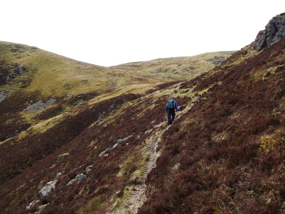
Choose your line carefully, as nearer the wall you’ll find the ground to be an ankle wrenching mix of loose boulders, moss and heather where none of your footfalls will be confident. Aiming further left and taking a direct line upslope seemed to work best.
Follow the wall for a short while, to the pint where it turns slightly right on a broad ridge and starts threatening to descend, you’ll be at the right spot when you can just about start seeing Llyn Arenig Fawr. Again you’ll need to set off uphill through the heather. You’ll see on the 1:25k map that there’s a ledge at around 600m following the last crags of Daear Fawr and avoiding further craggy ground to the east, this is what you’ll be aiming for.

The going is initially heavy, but skirting around the crags, and straight onto their top, you find the ground steepness and heather cover eases. There’s also a definite, if vague, path which soon takes you to the edge of the Simdde Ddu cliffs of on a delightful, if airy, path. On a fine day, this is one of the finest short stretches of path that I’ve found – being more so as it appears from nowhere.

The track again becomes intermittent, but the ground is easy, as far as Bwlch Blaen y Nant, where you’ll join up with the Arenig Bothy track. This gently rises across Arenig Fawr’s eastern flanks, before taking a final, rocky pull up to the summit. You can then descend by either route detailed in this route, we chose to descend via the bothy, which is the shorter of the two and easier.


Local Information and Recommended Maps and Guidebooks
Route Summary:
This walk includes the Washi of Arenig Fawr
This walk includes the Hewitt of Arenig FawrThis walk includes the Nuttall of Arenig FawrRoute Start Location:
| Distance |
Ascent |
Time |
| 12.32 km | 687 m |
Calculate the time using Naismith’s Rule and factor in your own pace.
Activivity Type: Hard Walk
Summits and Places on this Route


Facilities
Check out the businesses nearby for more places to stay and drink.
Hazards
Remember that we cannot outline every single hazard on a walk – it’s up to you to be safe and competent. Read up on Mountain Safety , Navigation and what equipment you’ll need.
Parking :
Public Transport:
Weather Forecast:
Met Office Snowdonia Mountain Weather
Check out our Best Mountain Weather Forecast?
| TGF0bzozMDAscmVndWxhcg==
|
TGF0bzozMDAscmVndWxhcg==
|
TGF0bzozMDAscmVndWxhcg==
|


Guidebooks:
| TGF0bzozMDAscmVndWxhcg==
|
TGF0bzozMDAscmVndWxhcg==
|
TGF0bzozMDAscmVndWxhcg==
|


![]()
Dave Roberts
More Posts by Dave Roberts

Tryfan South Ridge Grade 1 Scramble

Walk to Llyn Llywelyn from Rhyd Ddu
